From: Poolewe
To: Lochinver
Distance: 136 km (est.) - covered in 8 days
This trip was a very special one to me. I feel matured by it. Compared to my previous hikes it felt like a step up, since there was, for a big part of the trip, no trail.
But there was more to it. Sometimes it was wet and cold, and I managed to dry my damp sleeping bag and clothes when the sun peeked through the clouds. I camped on a peak. I walked through swamps and around quicksand. I crossed a fjord on my packraft. My shelter was tested by wind and withstood. I was surrounded by animals and plants which are very rare in Belgium.
There were so many small things that I didn’t expect, or that I was not too confident about, but that I found peace with in the end. My confidence has gotten a little boost.
I think I will no longer view myself as a noob hiker. Yay! But of course, I’m still a fool in many other things… Hah.
I think this trip is a very interesting one, but also a bit strange. Interesting because it is quite a diverse trip, connecting Wester Ross with Assynt. But strange, because this diversity contains a village full of tourists and quite some tarmac in the middle of the trip. In hindsight, I could either have tried to bring something with wheels for this section, or, better yet, but quite risky and less predictable, I could have crossed Loch Broom differently.
In fact, I had planned quite a bit less tarmac on this trip, but a breeze which blew East on the fifth day and a huge impassable fence on the sixth day made all the difference.
Video report
Feel free to play your own favorite music while watching this video
Written report
Day 1 – An evening walk
I arrived Poolewe around 6 pm from Edinburgh by bus and a hitchhike. It’s funny to think back of my hitchhike preps. I ignored all passing cars and took 10 minutes to think over how to succesfully hitchhike and prepared myself psychologically. I positioned myself near a signpost to Poolewe. When I finally felt courageous enough, and yet another car was about to pass by, I thought: “Ok, let’s start with this one”. I pointed one hand to “Poolewe” on the signpost, while making the hitchhike sign with the other, and, much to my surprise, that first car already came to a halt.
It was a lady who had a Bed & Breakfast in Poolewe, and she was very hospitable, getting my attention to all the interesting spots we passed by on the road. That evening the sun was shining and lit all those spots in a beautiful ember while a turquoise sea served as a backdrop. It was a very scenic drive along the coastline to Poolewe. I bet the driver had hoped I was looking after a bed. Unfortunately for her business I immediately started hiking to Loch Maree as we arrived Poolewe.
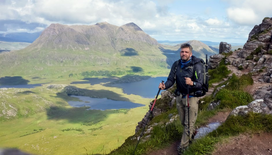
When I reach the pass to Loch Maree, which serves me with an astonishing view of the Maree islands and Letterewe Forest, I receive an email of my buddy Ivo, recommending me to sleep on one of those islands. I originally had planned to visit these islands the next day, but I can’t resist Ivo’s suggestion. Because it is deep summer, the sun will only set at 11pm, so I can make it. But little did I know I’d feel tired to death the next morning. I carried food for 9 days, a packraft and a bit too much of a defense against midges, resulting in about 20 kilo on my back.
My pack, an Exped Lightning 60 carries the weight as a charm. But my muscles aren’t up to it yet. In fact, I have never carried this much weight in 10 years. Add to that the hurry I have to reach the island before darkness falls, and my first encounters with the infamous peat bogs. Man, does that bog slow you down!
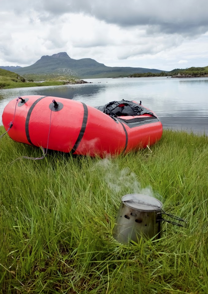
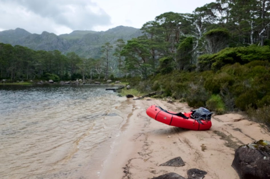
Around 10 pm I reach the shore of Loch Maree, but only by slogging through land that’s full of chopped wood, in which I sink to my knees. I’m relieved to flee into my packraft, and with help of a light breeze I reach a very nice beach on the first island I encounter.
I set up my tent, a Seek Outside Silvertip. I encounter some midges, and find out Smidge is working really well, so much so, I won’t need my headnet anywhere on the trip. I sleep on my soft packraft, and apparently the midges don’t care to enter my tent, when zipped closed. Apparently the sod cloth of my shelter is effective.
My first camp, sheltering on the beach of Eilean Ruairidh Mòr
Day 2 – Packrafting Loch Maree
On this day I wake up exhausted. Yesterday had been hard on me. I depart around noon, and paddle between the many islands of Loch Maree, whilst alternately taking shortcuts, hiking over the islands. The islands are densely grown with old Caledonian forest, which contrasts with the rather treeless Scotland. Loch Maree protected these islands from deforestation in centuries past. The undergrowth on the islands is sometimes harsh to bushwhack your way through. Nevertheless this is a wildly beautiful and remote spot for adventures.
During one of the shortcuts overland I find a small channel, so I float through it. At a certain point it gets too shallow and my butt scrapes over the bottom. I get out and push the packraft forward with my paddle. Not too clever actually. The wind throws my packraft upside down and my attached backpack gets soaked underwater. In camp I’d discover quite some water inside my drybag, which was actually packed inside my backpack to protect my clothes and food from dampness. The drybag, a gift from Mark Roberts, was leak like a sieve. I’d better use it as a shower bag. The following days even ordinary rain would seep in. Thanks Mark for the gift.
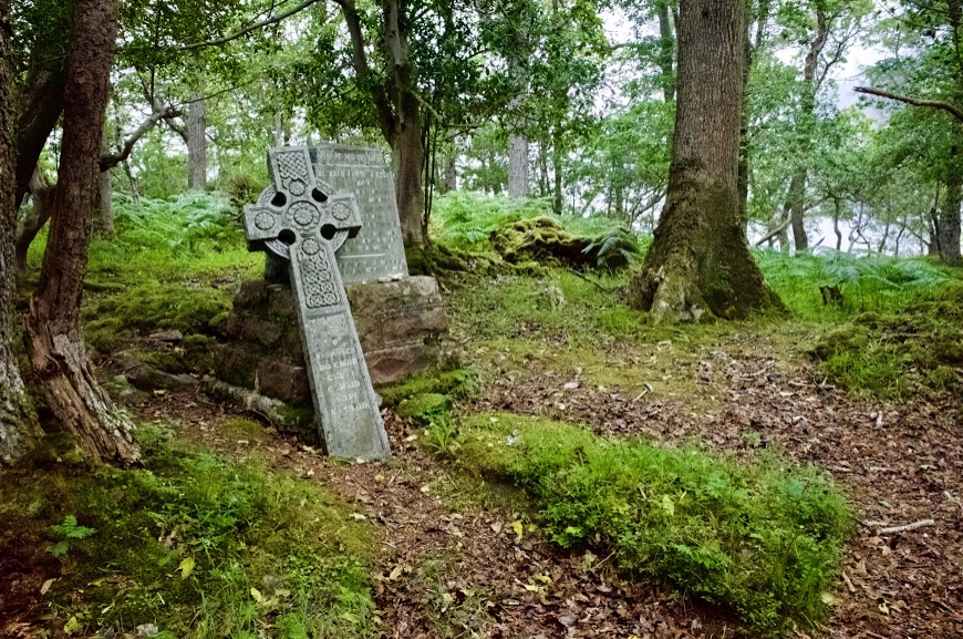
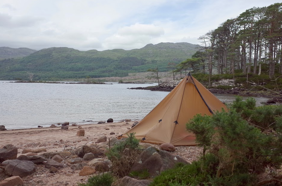
The last island I visit is Isle Maree or Eilean Ma’ Ruibhe, a sacred island with ancient graves of Vikings and Druids. I of course haven’t removed anything from the island, as legend tells it brings bad luck. I paddle to the shore of Letterewe forest to start my hike to Loch Gharbaigh, where I, again exhausted, pull up my tent near the lake shore. It has been raining all afternoon and evening, and this would continue on the next day.
Visiting one of the many islands on Loch Maree
Day 3: Magical Fisherfield
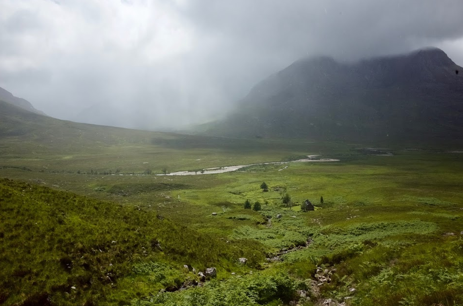
I wake exhausted again, and find my material slowly wetting out. It’s quite cold and wet. I had planned to trek to A’ Mhaighdean and Loch Ghiubsachain today, but being exhausted I realize this is not a feasible plan. The constant rain and mist also makes me feel a bit less energized. I decide to get as near to the Shenavall bothie as I can, so I can resort to a dry place, if need be.
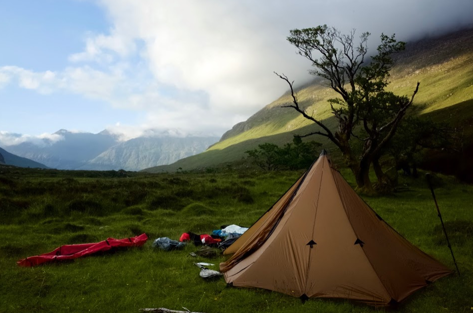
After a short climb I cross Lochan Fada by packraft, and continue to the pass near Stac a’ Chaorruinn to descend into the magical valley of Gleann na Muice. There’s frogs and deer everywhere. The deer aren’t too afraid and remain quite close. I find a dreamy spot near the river with soft grass and a couple of trees full of character. While I pull up my tipi, some curious deer get quite close. It stopped raining. I hang my clothes and sleeping bag out to dry in the weathered trees. As the evening sets, clouds disappear and alpenglow appears all around. Suddenly the air feels very dry. And I feel instant happiness. I have a great nights sleep. At last.
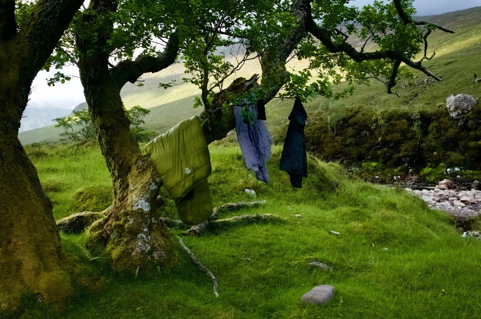
Hanging out my sleeping gear and clothes to dry as evening sets
Day 4: Dundonnell
I wake much energized. The morning is dry. I pack and leave early. The walk through the valley is easy but still amazing. It’s as if there’s a special kind of energy in this valley, very peaceful. Early noon I reach the Shenavall bothie. Nobody is inside. I haven’t seen a living soul yet since I left Poolewe, which is pretty amazing.
But as I have lunch in the bothie, I note the house attracts outdoor enthusiasts like a magnet. A trailrunner comes in, as does an older German woman who is crossing the UK north to south on foot. I’m impressed by her gear, she’s carrying many items which are being preached on BPL, such as a pot cozy and Dirty Girl gaiters.
After enjoying my coffee brew, I continue to hike to Loch Broom. It is a fairly easy hike, with clear paths and in the evening even tarmac, but the distance covered is quite great. It rains again, and it becomes very windy. It’s a bit chilly. I pass a group of young men that look like they’re performing for the movies, jumping uphill from rock to rock tirelessly, wearing shiny new orange Scarpa boots, bold sunglasses and stylish T-shirts in rain and mist.
From Dundonnell onwards is a lot of tarmac, a bit too much of it actually. I pitch my shelter on a hill top near Loch Broom, looking down on the fishing town of Ullapool by night. The wind picks up, giving a strong breeze (40 km/h). My shelter twists and shakes. I’m a bit worried, but apparently it holds very well. The stakes don’t budge. The stress on the trekking pole which supports the peak of my tipi appears to be almost non-existent. My confidence in the shelter improves. I’m worried though about my plan to cross Loch Broom (a fjord) with this much wind. The wind blowing northwards however is optimal.
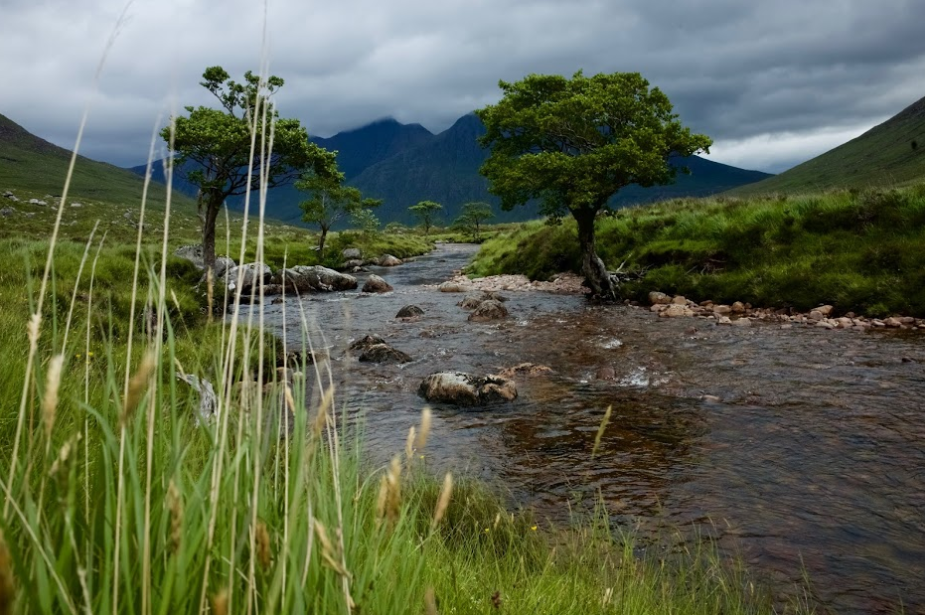
The Magical Gleann na Muice Valley with An Teallach in the clouds
Day 5: A bit of madness
Today is the day. I have to cross Loch Broom, which is quite big and tidal too. Wind is coming in from the sea. This is a part of the trip I have been a bit nervous about. I’m lucky, wind has softened to 20 km/h overnight, but the direction of the wind has shifted East, more or less perpendicular to my direction. I wait for the ferry to sail out of the harbor (to Stornoway on the Outer Hebrides) as not to hinder their course, take a deep breath and give it a go. I decide to cross in a V-shape, with the first part of the V upwind, and the second leg with the wind in my back. This way I can have a feel if I can handle the wind, and if not, return to my place of departure.
It takes me about 45 minutes to cross the sea. I moor at the camping of Ullapool, feeling very relieved and proud I made it. I get into the local store to buy myself a can of Coke and I’m off to Coigach. It’s easy to ignore all the food, I simply have no interest. Apparently the food I’m carrying is fulfilling enough. Ullapool seems to be a picturesque city, I will visit it at the end of this hike, while waiting a day for my bus connection back to Edinburgh.
I walk the busy road of Ullapool to the west, where I had planned to packraft to Isle Martin, and from there, along the shore of Ben Mor Coigach, to Isle Ristol. Unfortunately the wind is blowing inland (to the East). There is not enough time to complete the trip by paddling against the wind. I get off the tarmac and to walk to Coigach along the river of Strath Canaird.
It becomes an adventurous experience. First I have to bushwhack my way through huge ferns. Second I’m locked in by a myriad of fences, and need to climb over or find a way out. Last but not least, I have to walk through swamps and around quicksand for hours. It is very exhausting and feels threatening. The word “hate” has been in my mind a lot, referring to anything related to water. It was raining and misty, a full-on wet experience.
I planned to camp in a forested area to escape the horrible swamps, but when I arrive I’m met with a huge deer fence to protect the forest. It’s much higher than me, brand new and there’s no gate for miles. Being pissed off and exhausted, I think: “whatever”. I make camp on a drier piece of swamp. I use my packraft as a sleeping mat, so me and my sleeping bag will at least keep floating if the swamp wants to have me badly.
At night nature calls, I have to go for a pee. Everything being wet from rain and swamp, I decide to wear my GoreTex socks to get outside. That wasn’t my smartest move. The exit of my shelter is positioned towards a little slope, and I slip. I fall *bang* right onto my tipi, which is erected with my trekking pole and pole extender. The ground swallows my trekking pole under my weight with the greatest ease. Fortunately I could pull out the whole trekking pole, but my zPacks carbon pole extender, which Ivo specially brought for me from the USA, is buried in deep shit. I try to dig it up the next morning, but it’s past hope without a shovel. My paddle isn’t rigid enough to cut through the roots of all the swamp vegetation.
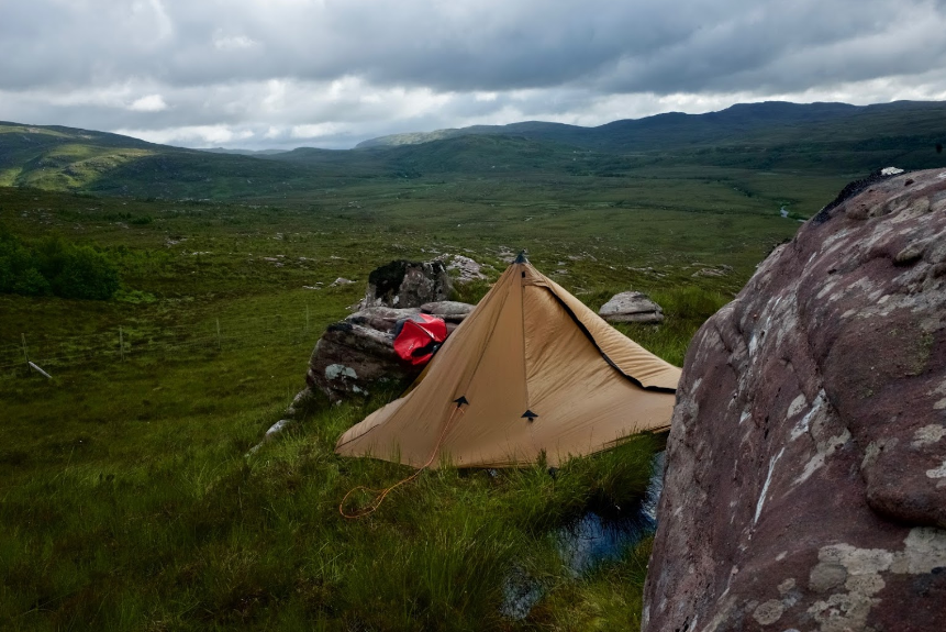
Notice how part of the tent is pitched over water. It was the best spot I could find in the swamp.
Day 6: Liberation
I wake up pissed as the swamp has me in its power. I’m looking at the fence which reaches 2 meter. Behind it is a liberating forest. But I’m locked out. I decide to follow the fence, hoping to find a way through. Instead it carries me back to the tarmac roads. I spend the whole morning walking on swamp and roads.
Sun seems to peek through for a couple of minutes at a time. I try to dry my sleeping bag in the sun, but it’s really a hit and miss. The sunrays have their own way as they travel the landscape around me. Fortunately at noon the sky clears completely, and I find a way away from the tarmac and onto Stac Pollaidh.
It feels very liberating.
Away from the swamp.
Away from the tarmac.
Into the sun.
Into Assynt.
At last.
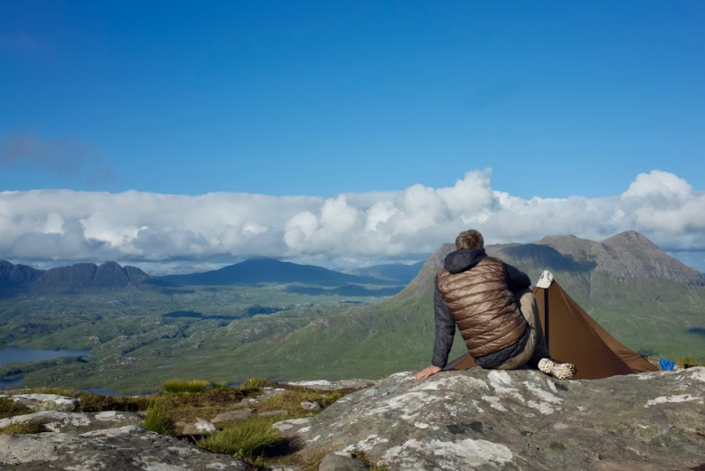
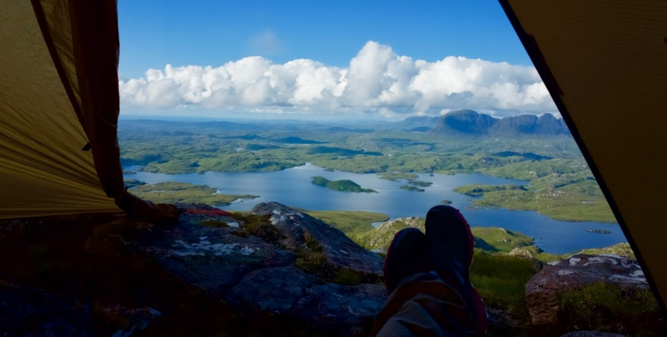
The view from Stac Pollaidh is breathtaking. I check the weather forecast. No wind and a bright sky. What more could I wish for? I decide to call it a day and to camp right onto the lesser peak of Stac Pollaidh. It’s the first time I’m camping on a peak. Usually I camp in sheltered spots. It feels very exciting to do. And it is. It is unforgettable. It’s way better than what I had imagined looking at amazing pics of fellow hikers online.
I can see all of Inverpolly and the lake I’m about to paddle tomorrow. I plan three hours to cross Loch Sionasgaig to get to to Suilven.
Many people are scaling Stac Pollaidh. Looking along the cliff I can see the nearby parking lot full of cars. Some people start to laugh in disbelief when they see my tent on the peak. Others seem rather annoyed. As night falls the cars depart. I’m all alone and have a sound sleep.
Room with a view: Inverpolly and Suilven.
Day 7: Inverpolly
I wake early and aim for Loch Sionasgaig. The weather is very kind today. The wind is soft and in a good direction. I paddle across the lake in an hour. I’m much ahead of schedule. From the shore to Suilven the soil is rather dry. I encounter many lizards. The walk is easy without the bogs. The landscape is pretty flat too.
I reach the South face of Suilven much earlier than anticipated. But when I look at the vertical walls of Suilven, it seems impossible to scramble my way up. My map doesn’t show a path either. But my role models Ivo and Joery have climbed it before and even camped on it. That really motivates me to find a track. I see a vague path crossing a steep slope of scree. It feels risky to do, but anyway give it a try.
Halfway I pass a man coming down. He assures me this is the right track and tells me there’s even an easier way down on the North side. I’m relieved to know that if I continued upwards, I have a crossover shortcut to Lochinver, the end point of my hike. When the scree slope meets with the mountain wall (which is very steep) there is a clear path up.
I feel ecstatic when I reach the saddle of Suilven. I can’t believe I’m standing on this impossible steep mountain (or should I say hill?). There is a very obvious path down the other side. That north side even provides stairs in the form of stepping stones, it looks much easier. Much to my surprise a procession of hikers is coming up from that side. While continuing to the very top of Suilven for 30 minutes, I must have crossed about 20 people.
I find lots of space for my tent on Suilven. It’s a very grassy and convex top. A campers dream! Of course I check the weather forecast before I raise the tent. Predictions are very good again. A very clear sky and almost no wind. But when I try to sleep the shelter shakes in a strong breeze and it is very humid and misty outside. I become anxious. This isn’t the place for bad weather, save a lightning strike. I check the weather again. But it still predicts a starry night and no wind. I’m confused. I decide to stay.
About an hour later, the mist pulls away, and I get to see the other summits. I’m totally enchanted. All other peaks are covered in lenticular clouds. I’m not so much enchanted by the view, but rather by becoming aware I was inside a lenticularis myself, which explains the wind and mist. This is truly an educational and unforgettable experience for me. I fall asleep in a romantic mood.
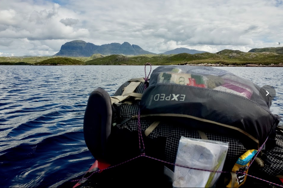
Crossing Loch Sionasgaig by packraft with a view on Suilven and Canisp
Day 8: Withdrawal
I rise with the sun, at 4 am. I have to arrive in Lochinver at noon to catch a bus to Ullapool. The walk down from Suilven to Lochinver is lit by the morning sun. Thanks to the midsummer sun I enjoy a really long golden hour. Any pictures made look stunning. When I get to the col on Suilven, where I can get down along the North side, I’m shocked to find a very prepared path on the way down, and even excavators parked on the grass to repair it.
The path is heightened from the soil with yellow sand, much like what you would find in a city park. Yes, this section truly was the proverbial walk in the park for me. I easily walked twice as fast as the previous days, but I found myself much isolated from nature. As if there had been a glass wall between me and the surroundings. I started to miss the frogs, the bogs and even the swamps.
I had been so intimate with nature the past days, this felt much like a withdrawal phase. Passing by the Glencanisp Lodge I can’t imagine hiking any popular trail like this one in the future. I feel like I’ve totally outgrown them. These prepped trails just lack the intimate feelings of connection I felt the past days. Connection to mother earth. Connection to myself.
Everything looks good in this sunlight
Route overview
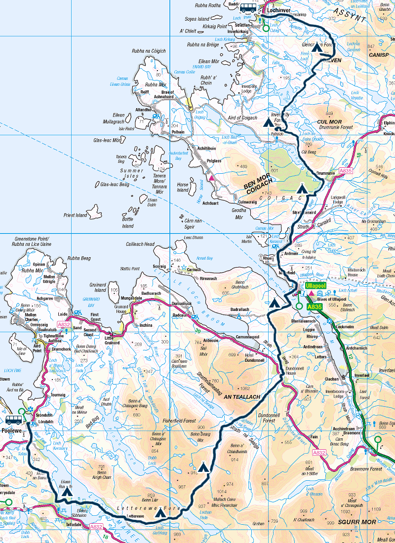
Map by WalkingHighlands
I’m very grateful for this trip, and I owe big thanks to Ivo Vanmontfort and Kasper Geuns for their input and support in planning this trip.
I had only about 10 days of time to decide where in Scotland I would trek and to prepare my hike, which is very tight indeed.
Regions on my mind were Skye and the Cairngorms. But I ultimately chose Wester Ross and Assynt because of their remoteness and wildness. I didn’t really plan a trip, I just marked some spots on the map that I read or heard about and wanted to see. But I planned my transport dearly.
Transport
Ullapool is easy to reach by bus, served by Citylink. I arrived from Edinburgh with a switch in Inverness. It was about a full day of travel.
As I wanted to visit both the South (Wester Ross) and the North (Assynt) of Ullapool, and didn’t want to walk in a loop, I had to find additional transport. Lochinver is very well served by bus (see google map), so this was a no-brainer.
In the South I really wanted to paddle Loch Maree, and found that Poolewe had the best connection from Ullapool, though it was still a weak connection (only one bus serving every other day).
Backed by the weather forecast (wind direction in function of my packraft sections), I decided to start from the weak connection in Poolewe, so that in case my plan wasn’t timed accurately enough, I could always hop onto another bus in Lochinver.
On arriving Ullapool (or rather the Braemore Junction – great place to get off, but not so much a good place to enter the bus. On the way back we raced by from Ullapool) I had a bus connection to Poolewe, but had to wait a few hours, so I tried (succesfully) to hitchhike. The rest of the story was written above.